Please wait...
Please wait...
Siloed systems make it impossible to leverage your ocean of information. CommandCentral Aware situational awareness software not only securely unifies all of your real-time data and video streams into a common operating picture, but also helps identify intelligence for users to quickly and easily share.
On a single map, see location and status of radios, cameras, 9-1-1 calls, incidents and other resources to increase operational awareness.
Connect, view and control real- time camera feeds from disparate video sources, organized the way you want, to provide additional eyes and ears on scene.
Trigger workflows for 9-1-1 calls, CAD incidents or other emergency alerts, assign work and run database queries to respond faster.
Communicate via email or message and collaborate virtually to connect teams to intelligence with greater speed and efficiency.
CommandCentral Aware is comprehensive and highly flexible, so that users and teams of all types, across agencies of all sizes, have the tools they need to enhance their situational awareness.

Unify 9-1-1 calls, CAD incidents, vehicles, radios, cameras, sensors and more on an Esri map. Layer traffic, weather, custom maps and floor plans.

Alongside the map, view events and device alerts in a table structure. Add, remove and sort data columns for individual user preferences.

Connect, view and control camera feeds from disparate video sources, organized the way you want, to provide additional eyes and ears on scene.

Directly message individuals and groups alongside channel-based communication. Share images, videos and documents. Establish inter-agency groups.
Configure reporting cadences for resources and activate breadcrumb-style tracking in emergencies. Affiliate resources together to create a single, clearly identifiable unit on the map.
Quickly access active resources or events on the map using a free-text search bar. Upon selecting, the map will center on the event or resource of interest.
Create geofences or 'Zones of Interest' ad hoc or at an administrative level for different users or groups to filter a users view of resources and events to a specific area.
Create area and unit specific, time-based checkpoints that verify a patrol has occurred including entry and exit alerts as well as notifications for incompletion.
Trigger workflow actions based on the occurrence of events, such as camera activation near a panic button alert, eliminating manual information analysis and processing.
Initiate a search or query across various sources, including VehicleManager, on highlighted text to gather more context on a situation and better inform a response.
Review responses through the lens of mapped historical events, resources and video. Replay the incident as it unfolded to expedite investigations and inform future workflows.
Draw polygons, polylines and points on the map with coloring, icons and annotations. Drawings are visible by all users as a map layer to improve coordination.
Share rich situational intelligence including video links, clips, snapshots and comprehensive incident updates via email. Export video clips and snapshots.
Apply enhanced user permissions by camera or camera group to granularly control who can view video streams, review historical footage and clip, snapshot or export video.
Access the map and event monitor from any Android or iOS tablet or smartphone to extend operational visibility to anywhere you have an internet connection.
Configure your experience on one, two, or three screens. Personalize the display to meet individual role needs and workflow preferences.
As soon as that call comes in, we have visuals. We’re able to describe, track, sometimes even identify the suspect right away ...we can give that information to the responding officers so they don’t walk into a dangerous situation unprepared.
Chief Chris Briggs
Glendale Police Department
We decided to partner with Motorola Solutions because we knew the success other cities had. The platform had the robustness we desired but was also easy to use for law enforcement personnel, both sworn and civilian staff.
Director Aaron Miller
New Orleans Homeland Security and Emergency Preparedness Office
I love that I can personalize CommandCentral Aware to how I function best. I use it every minute of every day, so I have personalized my product to see the things that I use most commonly.
Intelligence Analyst Jennifer May
Montgomery Co. Sheriff's Office
It’s hard to predict what the technology will be in another five or 10 years, but we have built a platform from which we can grow. As new technologies are introduced, it will be so much easier to integrate them into and expand on our system.
Kevin Phelps
City Manager, Glendale, AZ
Having the technology is like having a third person in each patrol car.
Chief James White
Detroit Police Department
Over 400 public safety agencies across North America use CommandCentral Aware.
More than 63,000 users of CommandCentral Aware situational awareness software.
Over 190,000 cloud-connected cameras streaming video to CommandCentral Aware.
Over 70 telemetry and video integration partners in addition to existing Motorola integrations.
Our annual subscriptions are primarily tiered by which modules are included. See the offer guide below for details.
Explore integrations across the Motorola Solutions ecosystem. Don't see one of your products? Reach out and see if an integration is available. We also offer an API for third party interfaces.

Accelerate aerial intelligence for first responders in the field. Request a BRINC drone with one click.
Learn more
Augment your real-time awareness with live drone and pilot intelligence from SkySafe in CommandCentral Aware.
Learn more
Improve situational awareness and officer safety by viewing live streams and location information from your SVX video remote speaker microphones.
Learn more
Empower your community to be an active participant in safety with the Protected Places Program.
Learn more
Break down communication silos between public safety and vulnerable locations. Receive panic button alerts in CommandCentral Aware.
Learn more
Securely livestream video from community partners ‒ businesses, schools and places of worship ‒ with a Safety Hub.
Learn more
Access device location and LTE-enabled video livestreaming with CommandCentral Aware and V700 body cameras.
Learn more
View the location of the M500 in-car video system on the CommandCentral Aware map. Access a live video feed to supervise and inform a response.
Learn more
Visualize drone locations and access livestreams alongside other critical resources and incident data on a single map.
Learn more
Increase visibility of hot hit detections, improve response with situational awareness and optimize future workflows to intercept more vehicles of interest.
Learn more
Display location and detail, including class of service and uncertainty radius, of a call from VESTA 9-1-1 in CommandCentral Aware on the map and event monitor.
Learn more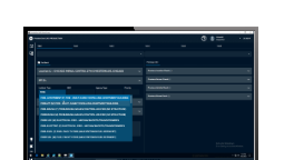
Trigger automation, such as streaming nearby video, based on PremierOne incidents. View incidents on an Esri-based map with unified event and device locations.
Learn more
Trigger automation, such as streaming nearby cameras, based on Flex incidents. View incidents on an Esri-based map with unified event and device locations.
Learn more
Clips and snapshots of video viewed in real time can be uploaded to CommandCentral DEMS for storage and management.
Learn more
View WAVE PTX device locations in real time. Replay device location as an incident unfolded to inform future workflows.
Learn more
See location for devices equipped with CommandCentral Responder. Track devices and replay their location as an incident unfolded to inform future workflows.
Learn more
Break down communication silos between public safety and vulnerable locations. Receive Rave Panic Button alerts in CommandCentral Aware.
Learn more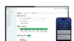
Keep your RTCC or EOC informed by viewing Rave Alert notifications in CommandCentral Aware.
Learn more
See APX radio locations and get status alerts when a situation escalates. Replay the location of officers as an incident unfolded to inform future workflows.
Learn moreCommandCentral Aware is cloud-native and meets or exceeds all major security compliances and certifications to keep your team working confidently.
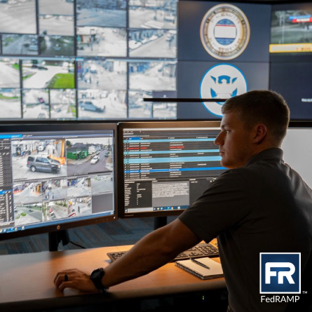
Compliant with Criminal Justice Information System (CJIS) requirements and can be hosted in a FedRAMP and StateRAMP authorized cloud.
Audited against Service Organization Control 1 and 2 (SOC 1 and SOC 2) reporting framework for secure data management.
Audited to achieve International Organization for Standardization (ISO) 27001, 27017 and 27018 certifications.


Securely third party cameras with a Safety Hub (formerly called an edge appliance).
Enable community partners to share emergency response information for enhanced real-time visibility.


Augment your real-time awareness with live drone and pilot intelligence.

Break silos to keep vulnerable places safe with panic buttons integrated in CommandCentral Aware.

Livestream LTE-enabled V700 body-worn cameras in CommandCentral Aware.

Get location and in-car video streaming from the M500 in-car camera in CommandCentral Aware.


Get emergency alerts and radio location for your operations center with APX radios and Aware.

Act fast on unusual activity alerts with CommandCentral Aware and Unity Video.


Intercept more vehicles of interest with CommandCentral Aware and VehicleManager.
Improved communication and situational awareness with APX NEXT and CommandCentral Aware.

Unified technology at Nampa PD improves officer safety, response time, and reduces crime.
Learn more
Learn how Glendale’s RTCC increased efficiency and community trust.
Learn more
See how the City of New Orleans protects citizens during large events.
Learn more
Learn how Detroit Police Department saw a 40 percent drop in violent crime.
Learn more
Discover how a real-time crime center delivers actionable intelligence to Montgomery Co. deputies.
Learn more
CommandCentral Aware saves Nampa PD officers hundreds of hours and helps get justice for citizens.
Springfield's Real-Time Analysis Center (RTAC) is using CommandCentral Aware to stay ahead of crime.
The Collier County ROC supported its community during Hurricane Ian using CommandCentral Aware.
How does CommandCentral Aware help dispatch stay two steps ahead?
The Collier County ROC provides emergency backup to its deputies with CommandCentral Aware.
AI nutrition labels provide information on if and how a product leverages artificial intelligence. Learn more


